Friday, July 31, 2009

Big Santa Anita Canyon + Scaling Mt. Wilson

Andrew got back this week from his trip to Kiwiland so you know what that means! You got it - a new hike. We picked out Sturtevant Falls, which is a part of the Big Santa Anita Canyon Loop, located in the San Gabriel Mountains above Sierra Madre, California. We didn't see any giant rattlesnakes like the Mt. Lowe hike, but I'll do ya one better.

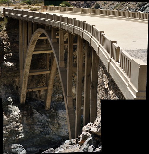
We set out from basecamp at Chantry Flat at about 9:00 a.m. in anticipation of a full day of climbing mountains and such. The very first thing you do on the trail to Sturtevant Falls is descend a ton of feet over 0.6 miles on a paved road. This is significant because we realized that we would have to revisit this daunting path in the opposite direction [up] after having hiked nearly 20 miles, most of which included scaling one of the largest mountains in the San Gabriel Range.


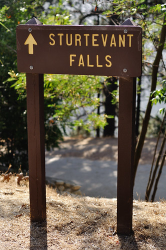
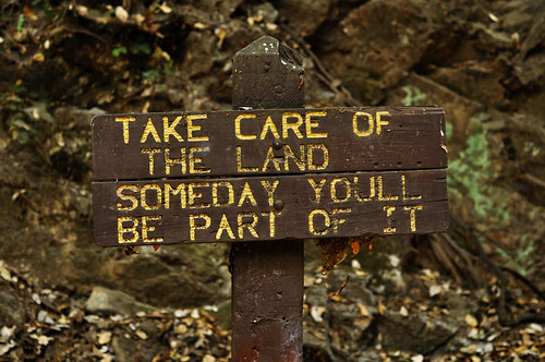
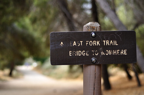
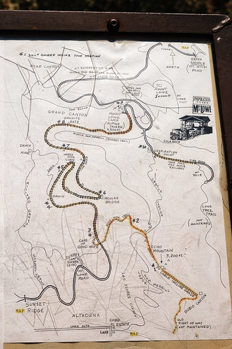
Optimism prevailed and we headed onward. It really didn't take long to reach Sturtevant Falls from Chantry Flat. Along the way, we encountered some wonderful signage, the likes of which I had never seen on any hike before.


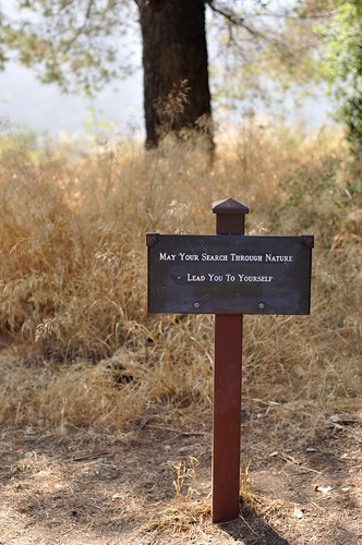
Because it's a bit difficult to see...


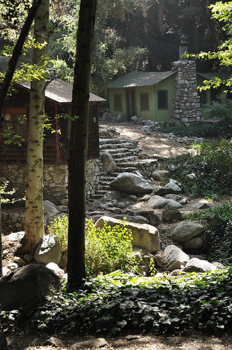
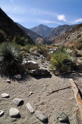
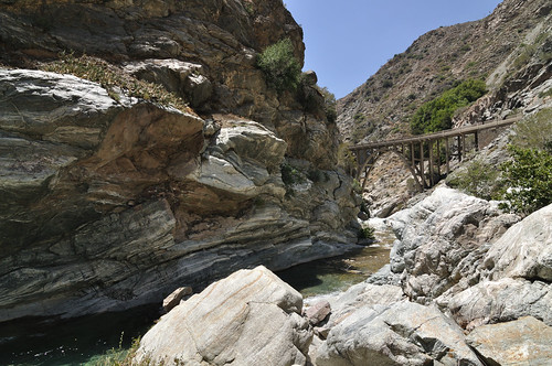
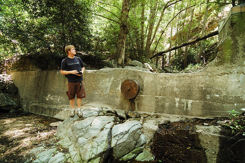
Well, we reached the falls after about 30 minutes of hiking. The water was just more than a trickle now in the late summer but I'm sure it's great when the snow-pack begins to melt in the late spring.


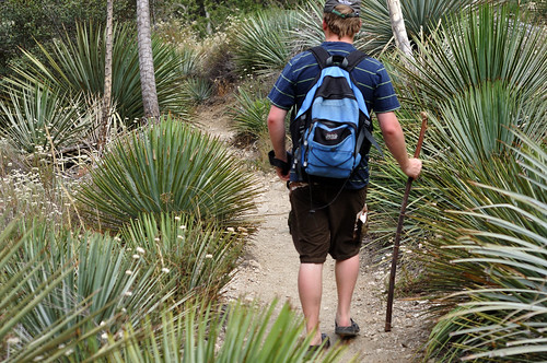
Very cool, secluded place. But the day was young! Mt. Wilson was next on the docket. We took the longer, roundabout way (which ended up being a much better choice than the straightforward way) because we would be hiking on the Rim Trail, which sounded cool. We had no idea.

Just before getting on the Rim Trail at Newcomb's Pass, Andrew and I heard something tumbling down the mountain in a flurry of snapping sticks and rustling leaves. Our first thought was that it was a boulder falling down, but it got too loud and didn't seem to have the characteristics of a falling rock. My next thought was that it was a Mountain Lion because it was moving very quickly and those cats are fleet of foot. All of the news stories about hikers getting attacked by Mountain Lions around the LA area flashed through my head and I was officially frightened.

The falling object was getting very close and then we saw it: a black bear cub, maybe 50 lbs., rolled out onto the trail about 15 or 20 feet ahead of us. My mind was racing at this point: baby bear wasn't a threat but baby bears don't typically travel alone. I was going to get the hell out of dodge before mom shows up to protect her kid. I did exactly what you're not supposed to do and bolted two steps back before stopping to look back. The cub looked confused; maybe it had wanted to walk on the trail we were on. It cocked its head then jumped off the trail and continued tumbling down the mountainside. Wow. Andrew and I didn't know what to do next. We didn't hear any larger animals coming down the mountain so after about a minute we started back on the trail. We dodged a massive bullet.

Needless to say, we took a breather at Newcomb's Pass - then on to the Rim Trail, which would lead us to Mt. Wilson. The word "trail" is used very loosely when describing the Rim Trail. Shoulder-width at its very widest, it is one of those trails where you hike one foot in front of the other and the ground is mostly loose sand with a steep, unforgiving fall of a few hundred feet. Intense! On top of that, it seemed an endless upward ascent. A couple of hours of relentless upward trekking. I guess that happens when there is a 3600' elevation gain from Sturtevant Falls.

We made it to Mt. Wilson...barely. I thought I was going to die. We spent about 45 minutes at the peak surveying the grounds and recovering from the ascent. The famous 100-inch telescope was a pretty awesome sight to see.


We took the Sturtevant Trail down from Mt. Wilson. Note: NEVER take Sturtevant Trail up to Mt. Wilson because it is nothing but very steep switchbacks up the mountain. I'm so glad we did the Rim Trail instead. Anyway, we labored back to that paved road up to Chantry Flat, which was a chore to get back up after all the hiking, and back to the car. This was the most intense hike we've done to date and I'm paying for it. I can hardly walk and I have a huge blister on my toe. But it was worth it!

Friday, July 24, 2009

A Night at the Beach

Tonight I went down to the Manhattan Beach Pier to try my luck at getting one of my favorite types of photos. A couple of years ago I ran across this gentleman's story and online gallery and his work fascinated me. The way he captures the South Bay is as inspiring as it is breathtaking.

So I took a whack at that style:

In order to truly get the most out of this photo, you should view it large or original size. I absolutely love how ethereal and haunting these images look and I can't wait more of them.

Until next time, amigos.

Sunday, July 19, 2009

Dodgers/Astros

Thanks to my good friend Gary, I acquired two tickets to last night's Dodger game versus the visiting Houston Astros. Gary wasn't missing anything as he had tickets for better seats so I went with dad.

The game was great. We put up two runs in the first inning and hammered it home in the sixth with three more runs. The 'stros scored two in the eighth to make it interesting, but Big Jon Broxton successfully closed out the 5-2 victory.


Aside from the win, there was a very interesting sunset phenomenon that produced a sort of explosion of light rays emanating from the northwest.


I recommend viewing this photo larger. The original size is also fun to look at.


I highly recommend viewing this photo larger but it's even better at it's original size.

Great game. Great day. Think Blue. Cheers!

Friday, July 17, 2009

Sweet Home, Indiana

Howdy folks! No hike this time - I went on an adventure of a different variety. Last week I headed back to Indiana for my former roommate's wedding (woo!). I was fortunate enough to be in the wedding as one of the groomsmen [read: carefully and meticulously selected from a deep reserve of the nation's finest groomsmen candidates {ok, maybe not, but I can walk down an aisle and stand up straight}]

Descending into Indianapolis I saw these magnificent clouds which I had to get a shot of. The image quality is awful (an artifact of me hastily rummaging through my carry-on to retrieve my camera and almost missing it entirely) but the image speaks for itself. I defy anyone to question the grandeur of Mother Nature.


Landed. Spent a night at home in Terre Haute. Headed to Shelbyville the next day for all of the festivities. The ceremony went off without a hitch (aside from the bride and groom who were certainly and most undeniably hitched) and my old roomie and his new wife officially set sail on their marriage.


*bonus semi-self-portrait


I had a great time seeing some very good friends and spending some quality time with my family but it seemed like almost as soon as I had arrived, it was time to leave. So back to Cali I flew (sans awesome cloud formations, unfortunately).

Until the next adventure,
Cheers

Sunday, July 12, 2009

Bridge to Nowhere

Last Wednesday Andrew and I traveled up into the San Gabriel Mountains north of Azusa to search for the Bridge to Nowhere (34.29242, -117.74317).


So here's the backstory (Wikipedia with the assist!): in the late 1930s the East Fork Road, meant to connect Azusa and Wrightwood, snaked its way above the East Fork of the San Gabriel river. Naturally, as these things tend to do, the road had to cross the river. A magnificent and beautifully powerful arch bridge was built in 1936 to span the river. The bridge was only two years old when a tremendous flood in March of 1938 washed out much of the road, forcing the cancellation of the project. The bridge was left and now has become an attraction for many hikers in Southern California.

The prospect of an abandoned bridge built in 1936 sold Andrew and I on this hike. The trail (some of which had itself been washed out) crossed the East Fork several times and led us through various terrain types. One moment we were tiptoeing across an almost shear face using not much more than footholds and the next moment we were trekking through a Yucca-infested river valley.


In fact, we ran into (sometimes literally) so much Yucca *shudder* that the very mention of its name sends shivers down my spine. I am certain that the purpose of these dastardly plants is nothing more than present a very prickly hazard to intrepid hikers - and I certainly had my share of pokes.


Ouch!

Well, we eventually made it to the bridge. Having no traffic other than day hikers and the occasional bungee jumper (the bridge is owned now by Bungee America, Inc.), it was in pristine condition and looked probably as good as it did in 1936. The construction was gorgeous - very reminiscent of the strong architecture found in the buildings of early Los Angeles.


We crossed the bridge and surveyed the other side. There were some natural pools in the river just before the bridge so we decided to climb down and investigate further. After taking a breather, we entered the river and headed over to one of the pools. The water was absolutely frigid but it was so very refreshing after miles of hiking in the harsh desert sun. As I was standing in the pool I had the unsettling pleasure of feeling small fish nibble at my ankles. Of course, I had no idea there were fish in the pool when I first got in so these little guys freaked me out.


Having satisfied our desire to swim in a natural river-fed pool, we decided it was time to hit the ol' dusty trail; only this time, we wouldn't take the ol' dusty trail. Not content to simply take the same way back, Andrew and I thought it would be much more adventurous to follow the river out. See, at this point the tranquil river valley had transformed into a carved gorge - complete with 5-foot waterfalls and small rapids. The trail had moved from following the riverside to coinciding with the road built in the 1930s perched safely high above the canyon below.

The passage was rough and I'm sorry to say that I have no pictures of this part of the trip because I was more concerned with keeping my gear dry. In fact, I had one test when the water had gotten too deep to wear my backpack conventionally. I was holding my stuff above my head when I slipped on an algae-covered rock and started tumbling toward the water. My only reaction was to shoot my arm into the air as high as I could to prevent my gear from entering the East Fork of the San Gabriel River. Luckily, the only thing left untouched by the water was my backpack and its precious contents.

We passed the hard part of the river and made it back to the valley. After that it was a series of river crossings and yucca dodging. The hike was great. I didn't find it as strenuous as the previous two but I do have a piece of advice: do not forget water shoes!

Sunday, July 5, 2009

4th of July Festivities

I hope your Fourth of July celebrations were great (and safe)! This weekend was especially memorable for me because I got my brand new Nikon D90 camera on Friday afternoon.

Naturally, I had to try it out.

I scribbled down the series of streets that would lead me to that secluded spot on the Palos Verdes peninsula (from a couple of posts back) on a piece of engineering paper and set out about 30 minutes 'til sunset. My plan was to get there with plenty of time to set up a great shot and break in the new camera with a spectacular sunset. As I headed up the hill I realized that the marine layer hadn't burned off and that the spot would be immersed in clouds - but there was a silver lining to this story. I set up the tripod anyway and stayed until dark to get the light trails I had been trying for last time.


*Note: the pic got cropped so click on it to see it in full. Same goes for every landscape picture posted thus far. I'll work on that.
--UPDATE-- The problem is fixed! Just had to modify the template CSS a bit :)

The next morning (the 4th of July, if you're keeping score at home) I picked up my friend Cori to meet our compadre Adrian and his amiga Jessica at Ft. MacArthur in San Pedro. There was a ceremony for the ringing of the Korean Friendship Bell (which we missed because they did it early) and several vintage vehicles were on display.


This is the same place dad and I went for Father's Day but we missed something. Dad and I saw the Korean Friendship Bell and the southern part of the installation but we had not ventured up to the battery itself. It was amazing. We went into the Osgood and Farley Battery and explored the history. This place would have kicked some serious butt had the enemy been foolish enough to try to roll into the Los Angeles harbor. Long story short: we learned some awesome stuff and saw 18 feet of a 50-foot 14-inch-shell-firing battleship-destroying planet-exploding evil-grin-inducing hulk of a gun that was installed at Ft. MacArthur during its glory days.


Well, that would have been enough fun for one day but it's the Fourth of July! This only comes about once every year, I think. Dad and I headed over to one of his coworker's fiesta and had a good time. Andrew came over after a little bit and when it started to get dark he and I made the executive decision to go to a hill near LAX to see the area fireworks. From this spot we could see fireworks displays from the Coliseum, Marina del Rey, the Hollywood Bowl, El Segundo, and tons of other private ceremonies. Andrew was kind enough to lend me his tripod for the fireworks.


In other news: I <3 my new camera! Happy b-day, America. Live long and prosper.

Thursday, July 2, 2009

Millard Canyon and Mount Lowe

Yesterday featured another day hike with Andrew. This time we went to Millard Canyon in the San Gabriel Mountains above Altadena, California (34.21487,-118.147847 if you're interested). When Andrew and I were planning the hikes most piqued our interest, this hike shot up to the top due to its dramatic forested canyon (complete with running mountain spring water) and an abandoned mine at the end.

We had remembered reading in the reviews for this hike that it was a bit difficult to navigate without a map. Well, we didn't have a map of the area but there was a rudimentary map posted at the outset with, as it would seem, more historical significance than navigational usefulness. Well, I took a picture of the map (just in case) and this image, viewed on the 2.5 inch LCD display on my camera, saved our bacon so many times it's almost scary. Scary that we were very close to just walking away from it with nothing more than a mental image.


At any rate, off we went. The first portion was a fire road, which eventually caught up with Millard Canyon. At that junction followed the creek upstream. There were definitely signs of man, such as lengths of iron pipe and what appeared to be an old dam.


After a bit of boulder hopping, we took a small offshoot to a place that looked like storybook mine territory. Sure enough, after some searching, we found it. The entrance was obscured by a large boulder that had fallen in front, but it wasn't difficult to get into. After about 50 feet, the shaft opened up into a cavern which featured a large, very deep hole which I would not have liked to have fallen into.


A bit deeper we reached standing water that would end up being knee-deep. We took off our shoes and socks and waded through the shaft until we reached the point where the gold miners said 'screw it.'

Instead of hiking back down the canyon we decided to check out the old Mt. Lowe Railway. After a strenuous hike out of the canyon, we reached a more friendly trail where the old cable cars used to ferry people up to the Ye Alpine Tavern. The tavern, once a luxurious resort at the turn of the century, is now in ruins. We took a short break here and on our way out of the area we saw a giant black rattlesnake. It started rattling and I was thinking about trying for a picture but since I'm not Austin Stevens, I decided to give our friend all of the distance he needed.

The trail from Ye Alpine Tavern to Inspiration Point had been graded for cable car use, but no tracks were laid due to insufficient funds. After a short jaunt, we reached Inspiration Point. This place was neat because it featured a "World Famous Telescope View" with many telescopes set up to point out specific locations in the Los Angeles basin as far away as Catalina Island. Of course, the haze made it nearly impossible to see past Pasadena.


We descended into Castle Canyon after taking a short break at Inspiration Point. The descent was very steep and taxing, but we eventually made it to another old cable car track. Before continuing, we checked out the Mount Echo, which served as the final stop of the Great Incline Funicular of the Mt. Lowe Railway. This place used to be grand, as seen in the following photo courtesy of Wikipedia, but it is now in ruins due to vandals and Mother Nature.


We followed the road to Sunset Ridge Trail which, coincidentally, we were on at sunset. The trail took us to the Millard campground and our circuit was complete. The hike was fantastic and it's really cool to know there is so much history and so many interesting things right in our backyard.

I'll leave you with an annotated map of our route, but in light of the details that cannot be seen, this would probably be a better place to check it out.


*UPDATE
A great source of information on the locations we visited in this hike can be found here.