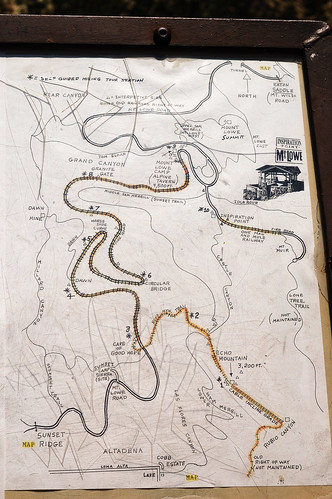
We had remembered reading in the reviews for this hike that it was a bit difficult to navigate without a map. Well, we didn't have a map of the area but there was a rudimentary map posted at the outset with, as it would seem, more historical significance than navigational usefulness. Well, I took a picture of the map (just in case) and this image, viewed on the 2.5 inch LCD display on my camera, saved our bacon so many times it's almost scary. Scary that we were very close to just walking away from it with nothing more than a mental image.
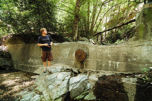
At any rate, off we went. The first portion was a fire road, which eventually caught up with Millard Canyon. At that junction followed the creek upstream. There were definitely signs of man, such as lengths of iron pipe and what appeared to be an old dam.

After a bit of boulder hopping, we took a small offshoot to a place that looked like storybook mine territory. Sure enough, after some searching, we found it. The entrance was obscured by a large boulder that had fallen in front, but it wasn't difficult to get into. After about 50 feet, the shaft opened up into a cavern which featured a large, very deep hole which I would not have liked to have fallen into.
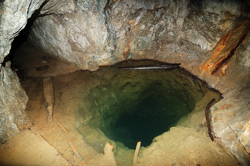
A bit deeper we reached standing water that would end up being knee-deep. We took off our shoes and socks and waded through the shaft until we reached the point where the gold miners said 'screw it.'
Instead of hiking back down the canyon we decided to check out the old Mt. Lowe Railway. After a strenuous hike out of the canyon, we reached a more friendly trail where the old cable cars used to ferry people up to the Ye Alpine Tavern. The tavern, once a luxurious resort at the turn of the century, is now in ruins. We took a short break here and on our way out of the area we saw a giant black rattlesnake. It started rattling and I was thinking about trying for a picture but since I'm not Austin Stevens, I decided to give our friend all of the distance he needed.
The trail from Ye Alpine Tavern to Inspiration Point had been graded for cable car use, but no tracks were laid due to insufficient funds. After a short jaunt, we reached Inspiration Point. This place was neat because it featured a "World Famous Telescope View" with many telescopes set up to point out specific locations in the Los Angeles basin as far away as Catalina Island. Of course, the haze made it nearly impossible to see past Pasadena.
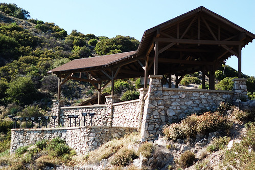

We descended into Castle Canyon after taking a short break at Inspiration Point. The descent was very steep and taxing, but we eventually made it to another old cable car track. Before continuing, we checked out the Mount Echo, which served as the final stop of the Great Incline Funicular of the Mt. Lowe Railway. This place used to be grand, as seen in the following photo courtesy of Wikipedia, but it is now in ruins due to vandals and Mother Nature.

We followed the road to Sunset Ridge Trail which, coincidentally, we were on at sunset. The trail took us to the Millard campground and our circuit was complete. The hike was fantastic and it's really cool to know there is so much history and so many interesting things right in our backyard.
I'll leave you with an annotated map of our route, but in light of the details that cannot be seen, this would probably be a better place to check it out.

*UPDATE
A great source of information on the locations we visited in this hike can be found here.


No comments:
Post a Comment